The Round Hill Society
The home site of the Round Hill Society, a community group of the residents of Round Hill in Brighton, England. The site contains information about the area, latest news and reflections on life in Round Hill.
Ditchling Road
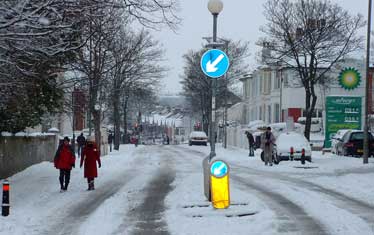
The western boundary of the Round Hill Park Estate runs along Ditchling Road from the junction with Bromley Road to the railway which tunnels under the current site of the BP Garage.
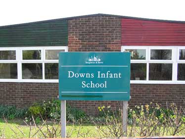
In this article, we shall include more of Ditchling Road up until The Jolly Brewer Public House. The land containing The Downs Infant School was once the site of Warleigh Lodge. What is now Florence Place was once the beginning of Dog Kennel Lane (later Hollingdean Road before Upper Hollingdean Lane was constructed meeting Ditchling Road further north).
From Bromely Road to Florence Place (The Jolly Brewer)
Round Hill Park Villas
Round Hill Park to Ranelagh Terrace
Ranelagh Terrace
Origin of Ranelagh
To the north of the Round Hill Park Estate
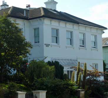
23 Ditchling Road: Round Hill House & Warleigh Lodge
The beginning of Hollingdean Road as in the1870s
The Jewish Cemetery
The Ohel
The Round Hill Park villas 1871
74 and 72 Ditchling Road
The side by side OS 25 inch 1892-1914 map shows the 4 large semi detached villa residences, still in existence today. These are located at 68 to 80 Ditchling Road - to the north of Bromley Road just south of the junction of Ditchling Road with Princes Crescent.
These villas were assigned to Round Hill Park in the 1871 census as well as in the 1878 Post Office Directory (top left hand corner of page 2866). They are also marked on the 1873 map (which you will need to drag and enlarge to find them!)
The Round Hill Park villas also include the three-storey semi-detached houses (originally 6 reduced to 5) on the north side of Richmond Road east of the junction with Princes Crescent as well as Warleigh Lodge on the site now occupied by Downs Infant School adjoining The Jolly Brewer Public House in Ditchling Road.
Below are some tips on how to use an online census to research the early occupants of the villas (still intact) on the east side of Ditchling Road between Bromley Road (north of Sylvan Hall) and the junction of Princes Crescent.
Practise using the Census data site e.g. study of Round Hill Park in 1871
- At http://www.freecen.org.uk complete these fields ONLY:
- Surname: Hollamby
- First name: Henry
- Census County: Sussex
- Census Place: Brighton
- Census Year: 1871
- Click the SEARCH button
- Select for all the information
- Continue viewing data for more households in the same street (or one nearby) by clicking the or buttons
You will gather data on everybody living in Round Hill Park in 1871, including servants.
Numbers 1-8 below comprise 4 semi-detached villas:
1 Round Hill Park Henry Hollamby (Livery Stable Keeper)
2 Round Hill Park Edward WATERMAN (Attorney)
3 Round Hill Park Edward TAINSH (Author)
4 Round Hill Park James L.W.DIXON (Retired Surgeon)
5 Round Hill Park Thomas RUSCOE (No occupation)
6 Round Hill Park William WALKER (Railway Store Keeper)
7 Round Hill Park Amelia E. NEWMAN (Scholar)
8 Round Hill Park Sarah PATEY (No occupation: aged 60)
Tower Mill Cottage George LUCK (Machinist)
Tower Mill Alfred NIGHTINGALE (Miller: aged 31)
Round Hill Park to Ranelagh Terrace
This section, which includes households 1-11 (see below) was later renumbered 68 to 82 and assigned to Ditchling Road.
Changes in occupants by 1878
Page 2866 of the 1878 Post Office Directory which also covers the Round Hill Park stretch of Ditchling Road shows some different occupants:
No. 1 is not mentioned.
No. 2 The Waterman family are replaced by George Funnel.
No. 3 Edward Tainsh (author) is replaced by Thomas Jackson
No. 4 James Dixon (retired surgeon) still lives here.
No. 5 Nobody listed
No. 6 William Coates replaces the Walker family.
No. 7 Edwin Dixey replaces the Willmot and Newman families
No. 8 Richard Howard now replaces Sarah Patey (widow aged 60)
No. 11 is now listed as the home of Henry Edwards
Tower Mill: Thomas Turner Brazier replaces Alfred Nightingale as the Miller & Corn Chandler.
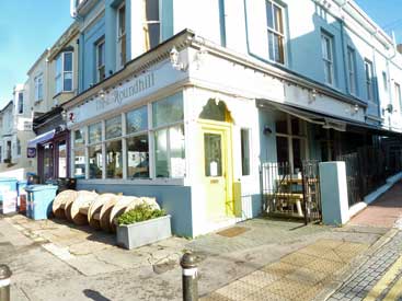
The Round Hill Tavern is now listed (George Willard)
The Willard family and two Round Hill Pubs
The Willard family play a significant part in supplying drink to Round Hill residents both at The Round Hill Tavern and at 31A Richmond Road soon to be listed in street directories (e.g. Pikes 1895) as The Victoria Inn.
The 1871 census has the 28-year-old George Willard living at 15 Southover Street with his wife Jane (aged 37) and two very small daughters: Ada J (aged 3) and Lily R (aged 2). His occupation in 1871 is given as a Hair Dresser.
By 1878, he is the occupant of The Round Hill Tavern
The 1891 census has the 23-year-old Ada Jane Willard as Licensed Victualler at 31A Richmond Road (soon to become The Victoria Inn), living with her 58-year-old mother Jane Willard. Incidently, Pikes 1889 Directory shows the enterprising Ada Jane Willard operating from 31A Richmond Road as a greengrocer.
Ranelagh Terrace (1871 census)
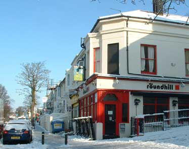
This next section of Ditchling Rd was then 1-17 Ranelagh Terrace. The Roundhill pub is now numbered 100 Ditchling Rd.
Known residents in 1871 were:
Henry MULLET of 1 Ranelagh Ter. (coachman)
George Carwardine of 10 Ranelagh Ter. (shoemaker)
Click on the provisional 1853 plan of The Round Hill Park Estate. Plots projected for Ranelagh Terrace are clearly marked out, stretching from Round Hill Road (the junction of Ditchling Road where THE ROUND HILL PUB currently stands) and finishing just two plots beyond the junction at the west end of Princes Road a little way south of where the BP garage stands now.
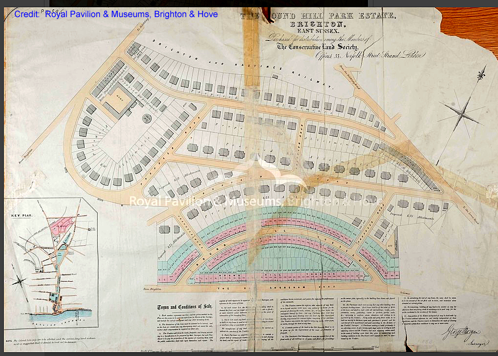
1853 plan of The Round Hill Park Estate prior to purchase of lots
Origin of the name "RANELAGH"
In No. 1442. vol X XVI. of BANKERS' CIRCULAR....., the name of The 7th and final Viscount Ranelagh appears as chair of a meeting at Freemasons' Hall on 28th June 1854 together with publicity for a meeting of THE CONSERVATIVE LAND SOCIETY on 6th July 1854 at 33 Norfolk Street, Strand, London.
The purpose of the Conservative Land Society meeting is the allotment of the Round Hill Park Estate (second portion).
There are SEVENTY FOUR plots to be allotted, of which one is a £400 lot, one £100 ditto, one £75, fifty eight £50 lots, and thirteen £37 10s ditto. The present picturesque portion is situated on the Ditchling-road, and is admirably adapted for villa residence, commanding splendid views of tho sea, the town, the race-course, the downs, and surrounding country. The Round Hill Park Estate is within the precincts of the town of Brighton, just beyond the level, on the way to Lewes, and has a considerable frontage onto the high road..
Plans of the Estate price 6d or 10d, if sent by post, mid prospectuses may be had of Charles Lewis Gruneisen (Secretary).
To the north of Round Hill Park Estate
The name "Ditchling Road" is resumed for postal addresses, approximately where the BP garage is now
(henry Geoffrey Scarratt.
However, even by 1871, there is not much development in this section.
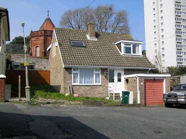
23 Ditchling Road (as numbered in 1871)
Round Hill House and Warleigh Lodge
23 (Round Hill House) 23 (Warleigh Lodge)
24 25 26 27 28 29 (Jolly Brewer Public House)
Page 2866 of the 1878 Post Office Directory discloses that
James Newman lives in Round Hill House (the first house logged as No. 23).
George Corney (the timber merchant recorded in the 1873 census) is still then the occupant of Warleigh Lodge.
As the The side by side OS 25 inch 1892-1914 map shows,
Warleigh Lodge, also recorded as No. 23, is actually on the site now occupied by The Downs Infant School.
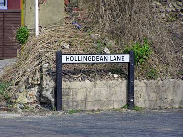
The beginning of Hollingdean Road [1870s]
The section of this street, beyond where it was blocked off up to where it rejoins what is now Upper Hollingdean Road (before the Victorian railway bridge), was later renamed Hollingdean Lane
Going back to the 1850s and 60s, the same section (beyond the Jewish Burial Ground) was known as Dog Kennel Road.
Now a Cul-de-sac called Florence Place
The beginning of the original Hollingdean Road (now a Cul-de-Sac named Florence Place) was at the junction off Ditchlng Road (just north of The Downs Infants' School) marked by The Jolly Brewers' Publc House (still present at the corner).
This was a straight route all the way through to Lewes Road.
The Jolly Brewer's Inn is marked under this name on the 1873 map. The occupants of No. 29 Ditchling Road in the 1871 census are publicans - Thomas and Sarah Burtenshaw (head). The 1878 Post Office Directory gives the name of Henry Geoffrey Scarratt as the next owner. The Jolly Brewer Public House (alternative name) dates back to as early as 1848 (when David Dunk was the proprietor). We learn from Brighton and Hove City Council's listing of The Jolly Brewer as a Heritage asset that Tamplin's acquired the property in 1874. Tamplin's was a well known brewer in Victorian times and their name also appeared on The Victoria Inn (built in the early 1890s) at the junction of Richmond and Mayo Road.
The side by side OS 25 inch 1892-1914 map shows a loop called "Hollingdean Road" in the THEN section on the left, but clarifies that this stretch west of the Victorian railway bridge is called "Upper Hollingdean Road" in the NOW section on the right. Access to this loop, suitable for heavier traffic, begins at the traffic lights further up Ditchling Road. The east end of the original Hollingdean Road, which is now known as Hollingdean Lane, joins Upper Hollingdean Lane just before the Victorian railway bridge. The section between the railway bridge and Lewes Road retains its original name "Hollingdean Road".
The original Hollingdean Road marked the old Brighton Borough / Preston Parish boundary. Preston was a very large parish. Although we associate it with London Road, it stretches as far east as Preston Barracks on Lewes Road.
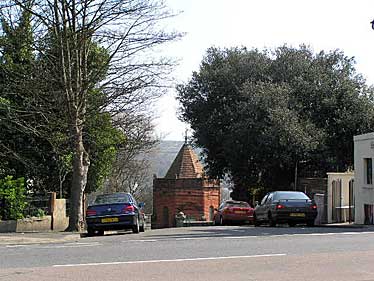
The edge of town was traditionally the place for burying the dead. The straight line continues up Bear Road, which you can see over the top of the Victorian railway bridge. As well as the Jewish Cemetery where Hollingdean Road used to begin, there are further cemeteries on both sides of Bear Road.
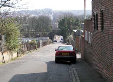
Today called "Hollingdean Lane"
To the right (in the above picture of the former Hollingdean Road) is a site which has had many different uses over time:
- From the 1850s, this was the site of the kennels donated by Thomas Read Kemp to the Union Hunt (Brighton's own hunting Harrier pack which had been relocated several times since 1761 when they were founded). The kennels were still present on the 1873 map, which labels the street as "Hollingdean Road" while still marking the kennels which gave rise to the name "Dog Kennel Road".
- The records at the Keep record a planning proposal for an abattoir (circa 1860) in Dog Kennel Road, though Brighton's Municipal Abattoir did not open on this site until 30 June 1896. No abattoir is shown on the 1873 map. Although opened to help reduce the number of insanitary slaughterhouses, the abattoir was closed in 1986 since it failed to meet stricter health standards (possibly eminating from the EU).
- On 19th June 2006, Veolia was granted planning permission for construction and operation of a Materials Recovery Facility and Waste Transfer Station on the (by then) Hollingdean Lane site.
The Jewish Cemetery (land gifted 1826)
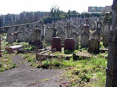
See record at The Keep dated 1826-1897
Deeds of the Jews' Cemetery, Hollingdean Road
(now Hollingdean Lane) and Florence Place, Brighton:
Description: the land for the Hebrew Burial Ground was gifted to Brighton Hebrew Congregation by Thomas Read Kemp on 19 January 1826.
An extension to the ground was purchased when Brighton Borough Council stopped up the west end of Hollingdean Road (now Hollingdean Lane).
The newly laid out Upper Hollingdean Road became the through route to Ditchling Road.
A further extension to the south of the burial ground was added in 1897 when Septimus Dixon of Warliegh Lodge, Ditchling Road, sold the congregation a plot measuring 78 feet by 45 feet for £250.
The Ohel (1893)
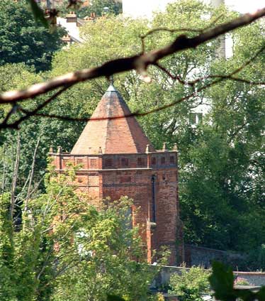
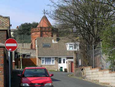
After the Council stopped off the west end of the original Hollingdean Road, a new zig-zag access was created on the east side of Ditchling Road just north of the railway tunnel mining under wha is now the BP Garage. So the entrance to what became Hollingdean Lane (after Upper Hollingdean Road became the main East -West access) was moved south.
The zig-zag stretch lacks pavements and street lighting so is unfriendly to pedestrians. Also a no-entry prevents vehicles from accessing the zig zag section from the east so there is little or no through traffic.
Hollingdean Lane has been used as a private access road for smaller Council vehicles to reach their depots.
When planning permission was given for Veolia's installations, there was both insistence that
- larger Council vehicles (or those belonging to Veolia) should not use this access
- a right of way should remain to allow pedestrians to use the old boundary road to get to the Victorian railway bridge on Hollingdean Road and to reach Lewes Road beyond.
I recall seeing the zig-zag stretch used by dog walkers and small street cleaning vehicles - perhaps a fortunate combination. There are now two houses where the zig zag meets the straight section.
Return to Main History Section.
This page was last updated by Ted on 21-Sep-2023